Geographic Information Systems
2U1K provides Geographic Information System (GIS) based support and studies at every stage of the projects it contributes to. These include baseline analyses, environmental and social impact and constraint analyses required during planning and site selection studies.
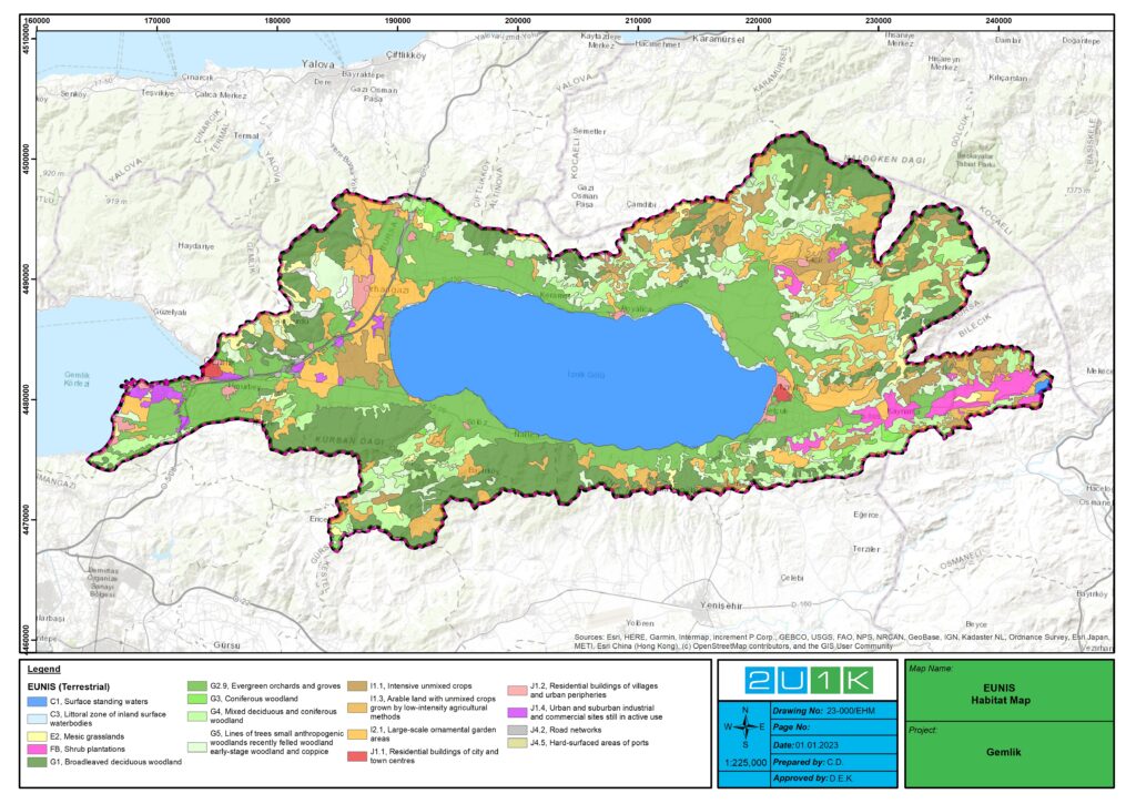
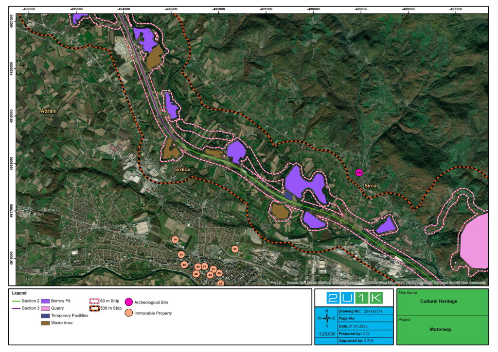
In the planning stages of the projects, GIS-supported baseline maps and constraint maps are created by using topography, site plans, hydrology, hydrogeology, forest stand data, forest asset data, environmental master plans, earthquake and fault data, geology, habitat, field study-based data and similar bases.
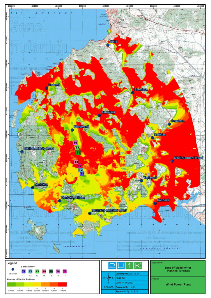
2U1K also conducts GIS-supported analyses and creates various scenario-based analytical studies for all processes of the projects. These studies include assessments such as site selection, stack emissions and related air pollution, noise, water quality, visual impacts, and impacts on critical habitats.
In mapping and development planning, the company specializes in the creation of detailed map bases for project areas. It also provides geographic data support for the planning stages of projects such as PIF, EIA, ESIA and ESMP, and helps to create map bases for environmental and social research, biodiversity and investment projects.